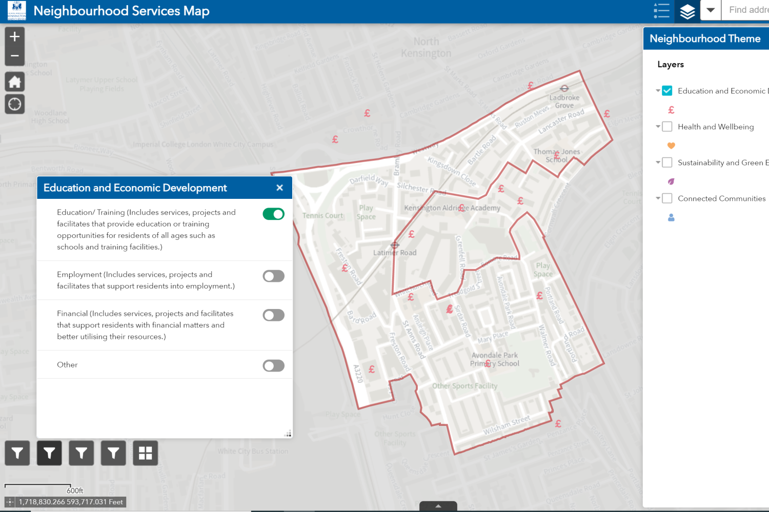

How to use the Neighbourhood Services Map?
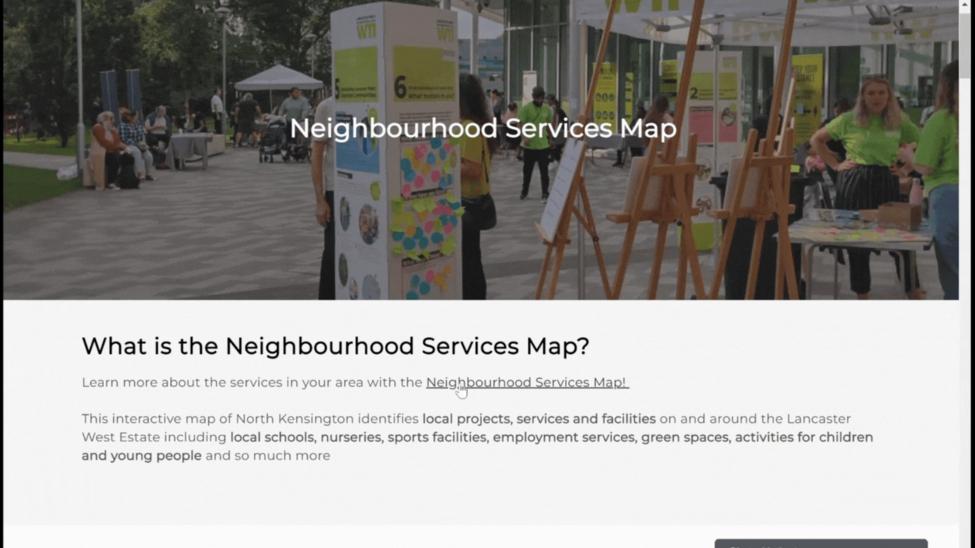
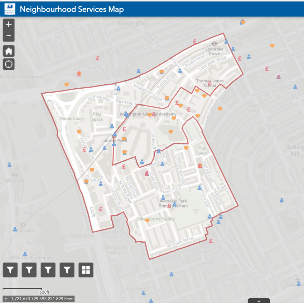
The map identifies projects, services and facilities on and around the Lancaster West Estate making it easy to find out information about what's available in your area.
Each project, service or facility has been categorised into four groups:
Education and Economic Development
Health and Wellbeing
Sustainability and a Green Estate
Connected Communities
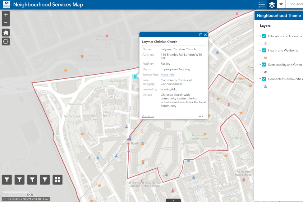
Once you find the pin you are looking for, you will see some extra information including the project, service or facility name, a short description, address and the relevant website.
If you are in any way struggling to the use the Neighbourhood Services Map, contact LWNT on lancasterwestoffice@rbkc.gov.uk or 0800 389 2005.
Each project, service or facility has been categorised into four groups:
Education and Economic Development
- Employment
- Education and Training Services
- Financial
Health and Wellbeing
- Food and nutrition,
- Physical Health
- Medical Health
- Mental Health
Sustainability and a Green Estate
- Green spaces
- Sustainable Practices
- Waste Management
Connected Communities
- Community Cohesion
- Resident Activism
- Transport
Once you find the pin you are looking for, you will see some extra information including the project, service or facility name, a short description, address and the relevant website.
If you are in any way struggling to the use the Neighbourhood Services Map, contact LWNT on lancasterwestoffice@rbkc.gov.uk or 0800 389 2005.
How to access the Neighbourhood Services Map?
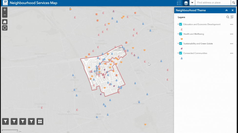
- You will be directed to another page with a map of North Kensington and the Lancaster West Estate in the middle. There are pins dotted across the estate and surrounding area that indicate the different projects, services and facilities.
- The Neighbourhood Themes are on the right-hand side which you can use to filter the pins by the four themes.
- On the bottom left-hand you can break the theme into side sub-category e.g., Education and Economic Development is broken into 3 sub-categories: "Education/ Training", "Employment", "Financial".
- Click below to access the Neighbourhood Services Map.
Try it out
How to move around the Neighbourhood Services Map?
How to find out more about a service, project or facility?
Filtering the Neighbourhood Services Map